Puget Sound Assistant Professor Andrew Gomez arrived at an Orientation session for first-year students this August with a tough assignment.
The students had signed up for what was billed as “an immersive experience,” an opportunity to spend time learning about the food cultures of Tacoma. A historian, Andrew had the task of introducing students, most of whom are not from Tacoma, to the complex historical forces that shaped the city’s neighborhoods. To do so, he had an ace in his back pocket, or maybe a better description is a link up his sleeve.
It was a digital history project, led by fellow historian Rob Nelson ’95, capable of laying bare right before students’ eyes the prejudices and discriminatory practices that have shaped not only Tacoma’s fortunes but the trajectories of cities like it across the country. At the project’s core is a series of federal government-produced maps and paperwork from the 1930s and ’40s that Rob and his team have digitized.
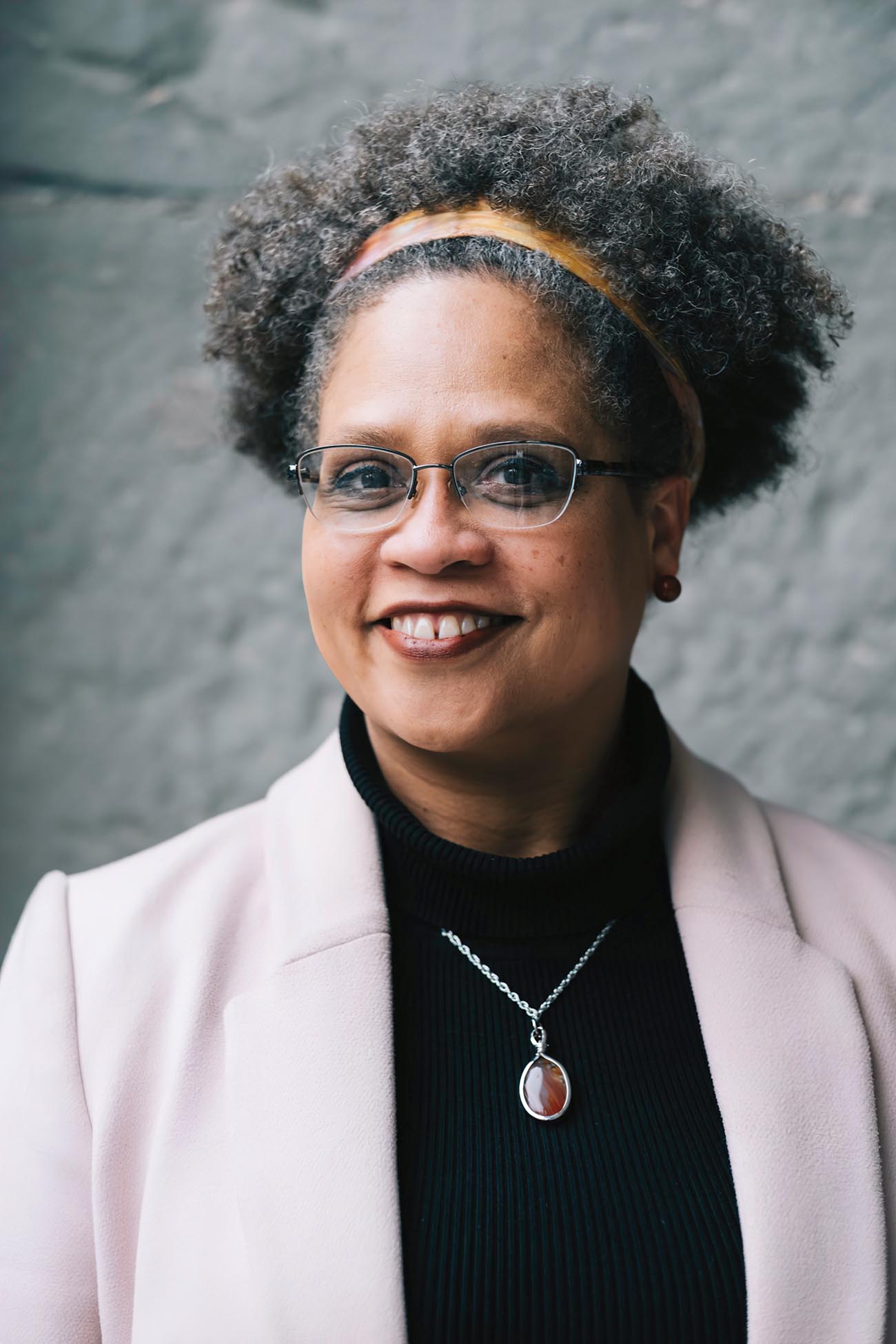
Rob Nelson ’95
Andrew began with a neighborhood labeled tract A2 on a map of Tacoma produced in December 1937 by the Home Owners’ Loan Corporation, or HOLC, a New Deal-era corporation set up in 1933 to stem the tide of home foreclosures during the Great Depression. As part of its work, the HOLC produced maps to rate the credit worthiness of neighborhoods in cities across the country.
Tract A2, which borders the northern edge of campus, is colored green, indicating it has the highest grade, “A.” A companion form to the map explains the reasons for the rating. It details, for example, rising home prices and residents’ income levels. On a line following the prompt “Trend of desirability next 10–15 yrs,” someone has typed “upward.” A section called “Clarifying remarks” at the bottom includes this line: “The location of the College of Puget Sound has definitely added to the attractiveness of the area.” Only 5% of Tacoma’s neighborhoods earned the coveted A grade.
Andrew likes beginning with this tract because he wants his students to understand that at the university, they are situated in a place of privilege. It was the most desirable location in the city when the map was produced, he says. “And one of the points of desirability is the College of Puget Sound,” he says. “So you get to see the long arc of how our university and our neighborhood, the North End, has been situated. And then you compare that to other neighborhoods in the South End and on the East Side that have been historically marginalized.”
One of these other neighborhoods was the go-to tract for Rob Nelson when, in 2018, he came to Puget Sound to talk to history majors about his work as director of the Digital Scholarship Lab at the University of Richmond, in Virginia. Digital, in that its projects are produced and consumed via computer. Scholarship, because its projects generate new knowledge. And Lab, because it experiments to find the best way to share what it’s generating. In his talk, he zoomed in on D1, a neighborhood that lies about a 10-minute bike ride northwest of campus.
Senior Research Fellow at the DSL
Ed Ayers
"History is not the list of names and dates that people always tell me they hate. It’s big patterns and big connections."
D1 was not green, but rather a tiny rectangle of red pulled out from the blue of the surrounding Proctor District, labeled B2. In the logic of the HOLC, if a neighborhood didn’t merit a green A rating, the next best option was blue, or grade B, which meant “still desirable.” Yellow, or grade C, was bad news; it stood for “definitely declining,” a rating given to 63% of Tacoma’s graded neighborhoods. The worst grade was D, which meant “hazardous” for future investment. Sixteen percent of Tacoma earned this rating. Areas graded D were marked red.
The accompanying comments for the tract labeled D1 note the oddness of singling out in red these few blocks of the otherwise blue Proctor District. “Except as noted in ‘Clarifying Remarks’ below, this area is identical in all respects with Area B2,” reads part of the form.
The “clarifying remarks” do, indeed, clarify. “Three highly respected Negro families own homes and live in the middle block of this area facing Verde Street,” someone typed. “While very much above the average of their race, it is quite generally recognized by Realtors that their presence seriously detracts from the desirability of their immediate neighborhood.”
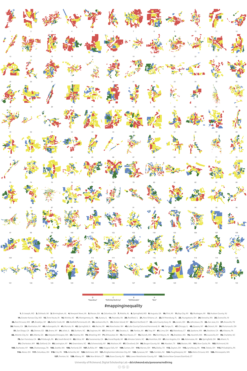
In this 1937 HOLC map of Tacoma, green denotes areas that were deemed minimal risks for mortgage lenders; red areas were considered "hazardous."
There, in plain red and blue tints painted over the Proctor District, is the discriminatory practice that came to be known as redlining. It resulted in widespread denials of mortgages, insurance, and other financial services to minority and immigrant neighborhoods across the country by stigmatizing them as unsafe for investment by banks and other lenders. Over the long term, redlining reinforced racial segregation in housing and exacerbated its attendant ills, such as unequal access to good public schools, grocery stores, and other services.
“That is the HOLC logic in a nutshell, right?” Rob says. “When they say, ‘very much above the average of their race,’ they just mean they’re black, middle-class families living in a middle-class neighborhood in the 1930s in a city where just under 1% of the population was African American.
“Three middle-class African American families live in this neighborhood, and that means it’s redlined. That is a real way of demonstrating the logic of this. Then you have to talk about the impact.” And the impact is striking: Based on census data, the zones marked red on the 1937 HOLC map are the same parts of Tacoma that are the most impoverished today.
Sitting in his family room in a leafy neighborhood adjacent to Richmond’s suburban campus, Rob describes himself as “a programmer more than anything. I mean, I’m a weird historian, in that I spend most of my time writing code.”
Old maps decorate the walls around him as he talks, many displayed in wood frames he has made by hand. A 1910 map he found in a shop in nearby Charlottesville shows the town in Ethiopia where his daughter was born. In another room, a French map from the 1680s shows the same area labeled with its name at the time, Abyssinia.
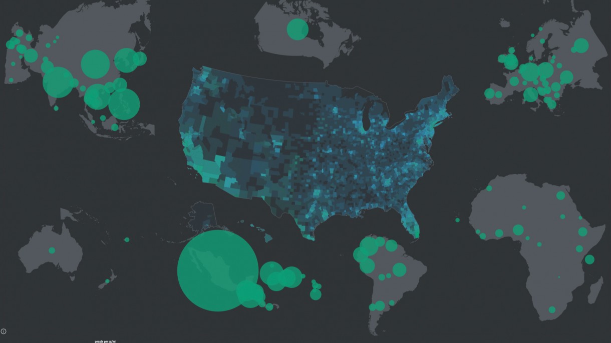
The maps that his Digital Scholarship Lab, or DSL, produces put information together in ways that allow for new interpretations of the past. “Foreign-Born Population: 1850–2010,” for example, uses census data to depict the migration of immigrants in communities across the country. “The Executive Abroad: 1905–2016,” shows foreign travels by sitting U.S presidents and secretaries of state, including Teddy Roosevelt’s 1906 trip to inspect the Panama Canal under construction, the first time a U.S. president went abroad while in office. “Visualizing Emancipation” maps the collapse of slavery in the Confederacy during the Civil War, showing thousands of “emancipation events”—say, enslaved men and women making the risky choice to flee for Union territory or aiding the Union army as informants or soldiers.
Several of these projects fall under a larger collection called American Panorama, which the DSL bills as a “historical atlas of the United States for the 21st century … designed to appeal to anyone with an interest in American history or a love of maps.” The redlining maps come from the latest American Panorama project, “Mapping Inequality: Redlining in New Deal America,” a collaboration among teams at Richmond, Virginia Tech, Johns Hopkins, and the University of Maryland.
American Panorama has earned a lot of attention, including from the American Historical Association, which honored it with its 2019 Roy Rosenzweig Prize for Innovation in Digital History. In 2016, The Chronicle of Higher Education named American Panorama to its list of “Tech Innovators.”
When Theodore Roosevelt traveled to Panama in 1906 to see the construction of the Panama Canal, he was the first sitting U.S. president to venture out of the country. "The Executive Abroad" charts the increase in presidential travel during the 20th century.
“History is not the list of names and dates that people in airports always tell me that they hate,” says the DSL’s senior research fellow Edward Ayers, who established the lab and recruited Rob to become its director. Ed is now president emeritus at Richmond.
“It’s big patterns and big connections,” Ed says. “We’re trying to make things that are not merely for today and not merely for an academic audience, but that speak to everybody.”
The field of history is in a far different place today than it was when Rob enrolled in a 300-level Japanese history course as a first-year student at Puget Sound. That class, he says, “was a kind of throwing me into the deep end” of what it meant to study history. “It took me, I don’t know, half a semester to figure out, ‘Oh, I’m supposed to be thinking about this, not memorizing.’”
From there, the Spokane native went east to earn his doctorate in American studies at the College of William & Mary. There, he also was introduced to an early effort in digital scholarship when he became involved with the Walt Whitman Archive, an ambitious effort to make a hypertext edition of the poet’s complicated, oft-revised body of work.
At the DSL, Rob often has to do something similar to what the Whitman Archive attempted, inventing new forms as analog information gets migrated to a digital format. Often, there is no guide. The format for “The Executive Abroad”—a circular map that shifts and spins as users click to highlight and sort information through space and time—is the design he says he is most pleased with aesthetically. “That one came to me in the middle of the night,” he says.
Other subjects await their epiphanic moment. Several years ago, the DSL digitized the seminal 1932 Atlas of the Historical Geography of the United States by Charles O. Paullin. Back-to-back pages in that atlas have maps showing an increase in tractors and a decrease in mules on farms across the U.S. from 1920 to 1925.
“That’s one map that I’d love to do—I haven’t cracked how to do it, but it would be the industrialization of agriculture and the effect of factory-farming and large-scale farming ecologically and on rural communities in the 21st century,” Rob says.
Problems like that make Rob half historian, half programmer. He, his staff—a visualization and web designer and a geographic information system analyst—and dozens of undergraduate researchers have produced more than 4 million images.
Rob Nelson ’95
"What we find interesting, hopefully other people will find interesting, but they will find other things interesting or important or impactful in these materials that we just didn’t imagine."
“Rob is inventing with each map a strategy that is custom made to the particular questions we’re trying to answer,” Ed says.
The rewards come for Rob in what he sees others doing with his maps. The DSL’s site, dsl.richmond.edu, earned more than a million page views in the past year alone from researchers, teachers, and historically curious average readers. Publications as diverse as National Geographic, the Cincinnati Enquirer, and The Architect’s Newspaper have used the DSL’s project on displacement during urban renewal in the 1950s and ’60s to explain the mechanisms of systematic discrimination.
Often, visitors use the site’s research in ways Rob never saw coming. In a 2014 essay for Perspective on History, an American Historical Association publication, he mused over an early review of the digitized Paullin atlas that called it a “particularly impressive example of online map porn.” The phrase “map porn” bugged Rob.
“Instead of grappling with the historical content of the maps, were visitors to the site only gawking at them as pleasurable aesthetic objects while playing around with the site’s interactive features?” he asked in the essay. He worried that public interest in the maps was shallow and that the maps’ historical lessons were being overlooked. “What I found instead was that my sense of history was too narrow, too disciplinary, too professional, so much so that I almost missed appreciating many of the diverse ways people made use and sense of the past,” he concluded.
This digitally created poster, while bright and colorful, conveys a darker truth: It shows how the Home Owners’ Loan Corporation graded cities from 1935 to 1940 based on residents’ credit worthiness—part of a controversial practice known as redlining.
A similar dynamic has been in play with the redlining maps of “Mapping Inequality.” People with a wide range of interests have applied the maps, and the data set underlying them, to a host of other purposes. Not long after “Mapping Inequality” was released, K-12 teachers began tweeting about using the maps in their classrooms. Researchers at the Federal Reserve Bank of Chicago used the maps and other data to examine the lasting effects of the HOLC maps, concluding that they “had an economically meaningful and lasting effect on the development of urban neighborhoods through reduced credit access and subsequent disinvestment.” A researcher at the Science Museum of Virginia sent people out on bicycles with thermometers to create heat maps of Richmond and found that the city’s heat islands overlaid shockingly well with the DSL’s redlining maps from eight decades earlier. He overlaid that data, in turn, with data from area hospitals about which neighborhoods were frequent destinations for ambulances responding to cases of heat stroke. Needless to say, the uneven impacts of climate change and heat distribution within cities were not on Rob’s mind when he and his team posted “Mapping Inequality.”
“One of the things I’ve really loved about ‘Mapping Inequality’—and it speaks to my background in American studies—is it gets used in ways I just would never have imagined,” he says. “What we find interesting, hopefully other people will find interesting, but they will find other things interesting or important or impactful in these materials that we just didn’t imagine.”
For Andrew Gomez, teaching history at Puget Sound, the redlining maps help him convey issues of discrimination and inequality as he talks about Tacoma’s changing neighborhoods, whether in his courses or at Orientation. When talking about, for example, the Hilltop—tract D5 on the map—he shows incoming students how, even in 1937, the neighborhood was being described as “the melting pot district of Tacoma” experiencing an “infiltration of lower classes, slowly”—largely immigrants from Asia and southern Europe—which earned it a D grade by the HOLC. Using these maps, Andrew can help students begin to understand and unpack the lasting legacy of deliberate policy choices that have shaped the Hilltop and other Tacoma neighborhoods. They offer historical context for the neighborhoods’ present dynamics and challenges, which suddenly feel far less inevitable.
“I had been using those maps before I knew who Rob was or that there was a Puget Sound connection at all,” says Andrew. I keep going back to the maps—because they just work.”
Rob Nelson is glad to see the DSL’s projects getting people of all kinds engaged with history, whoever they are and however they come at the information. The type of history he practices requires a kind of letting go. He can present a point of view with a title like “Mapping Inequality” and a manner of organizing information—or, as he puts it, “slightly stacking the deck”—but the user is ultimately in charge of the experience of consuming the information. They’re put in a position to experience history in the way that Rob figured out he needed to do back in that 300-level Japanese history course, making their own connections and constructing meaning, even if it sometimes happens in a map-porny kind of way.